Drones have become a real passion in recent years. I myself am convinced that drones can and will be used in an enormous variety of different fields and applications. Last month I saw a new camera from DJI (which will be released in 2021), a new type of sensor and my interest was aroused by the following video:
With a little search and some manuals on youtube, it turned out that there are already several applications that you can perform with a consumer drone (mapping, 3D video, measurement, …). I ended up with Dronedeploy where you can try the software for 2 weeks.
How does the software work: you specify a specific area and what exactly you want to get from the information (3D photo, the condition of the plants, the height, …), then the software calculates the flight time and how many batteries you need and how many photos the drone will take. Finally, you go to the relevant terrain and use the drone deployment app to control the drone. The drone automatically travels the calculated route itself and returns to the point of take-off. Then you upload the photos to the application dronedeploy and a maximum of 24 hours later you have your result. As mentioned before, the applications are endless. Here are some examples / applications that I have taken myself:
If you are interested in one of the applications, feel free to contact me
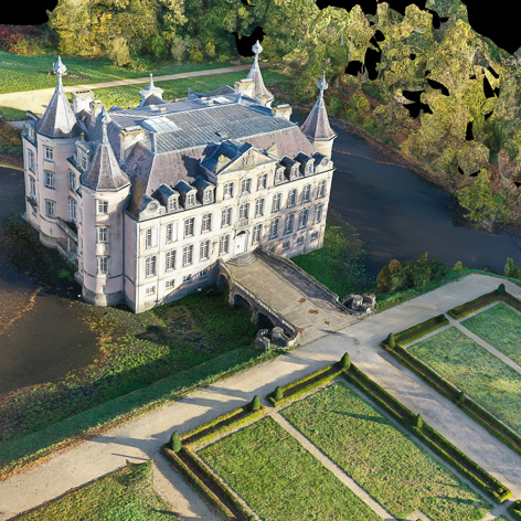
– Getting a 3D image from Poeke castle. This was made possible by pasting 910 high resolution photos together.There is even the possibility to send the 3D file to a 3D printer and print the model: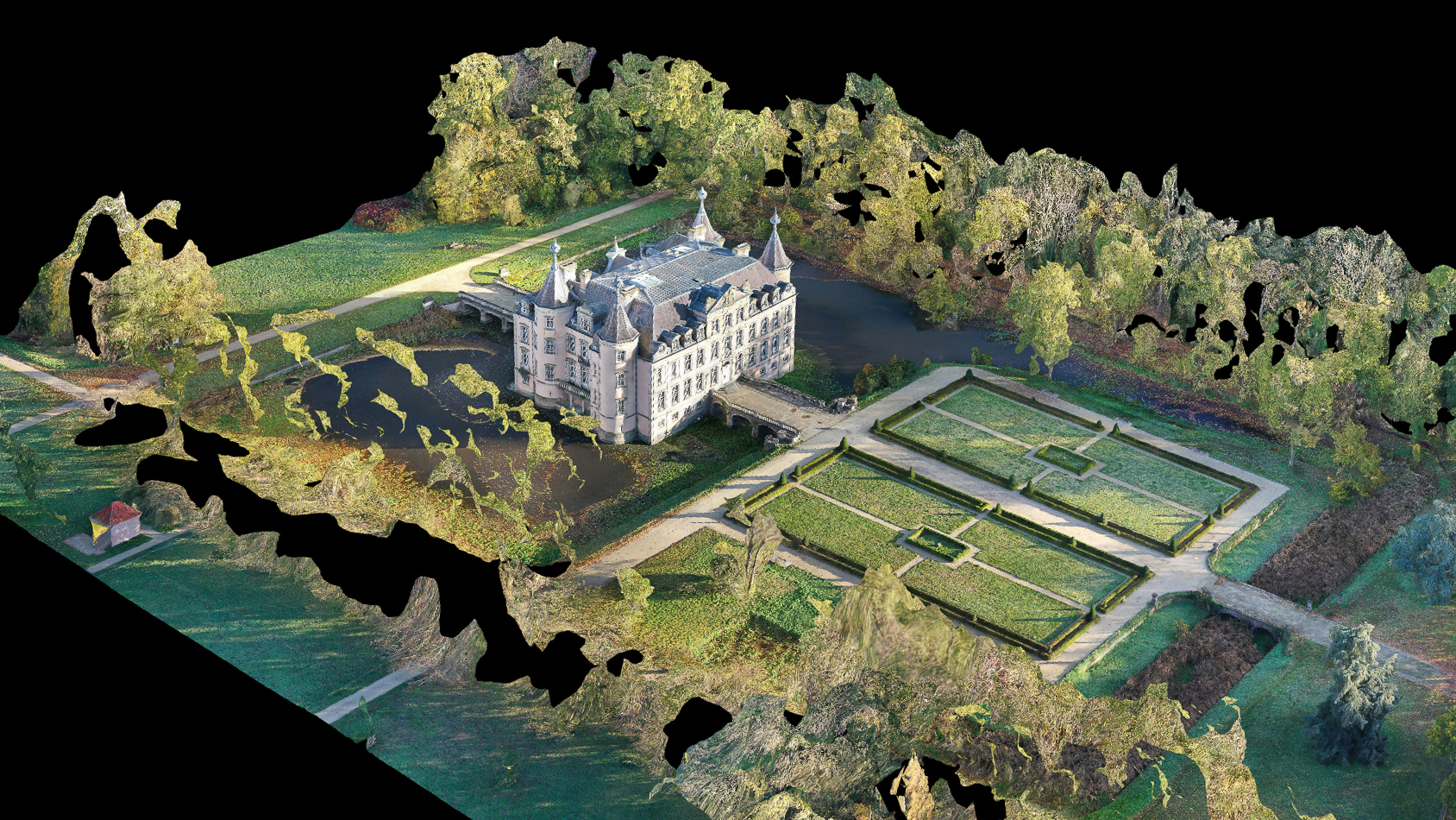
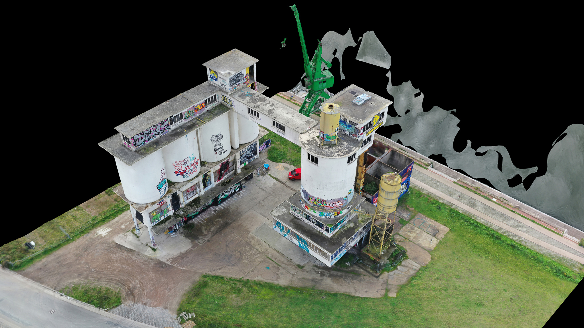
– Have a 3d model of the concrete plant that will soon disappear
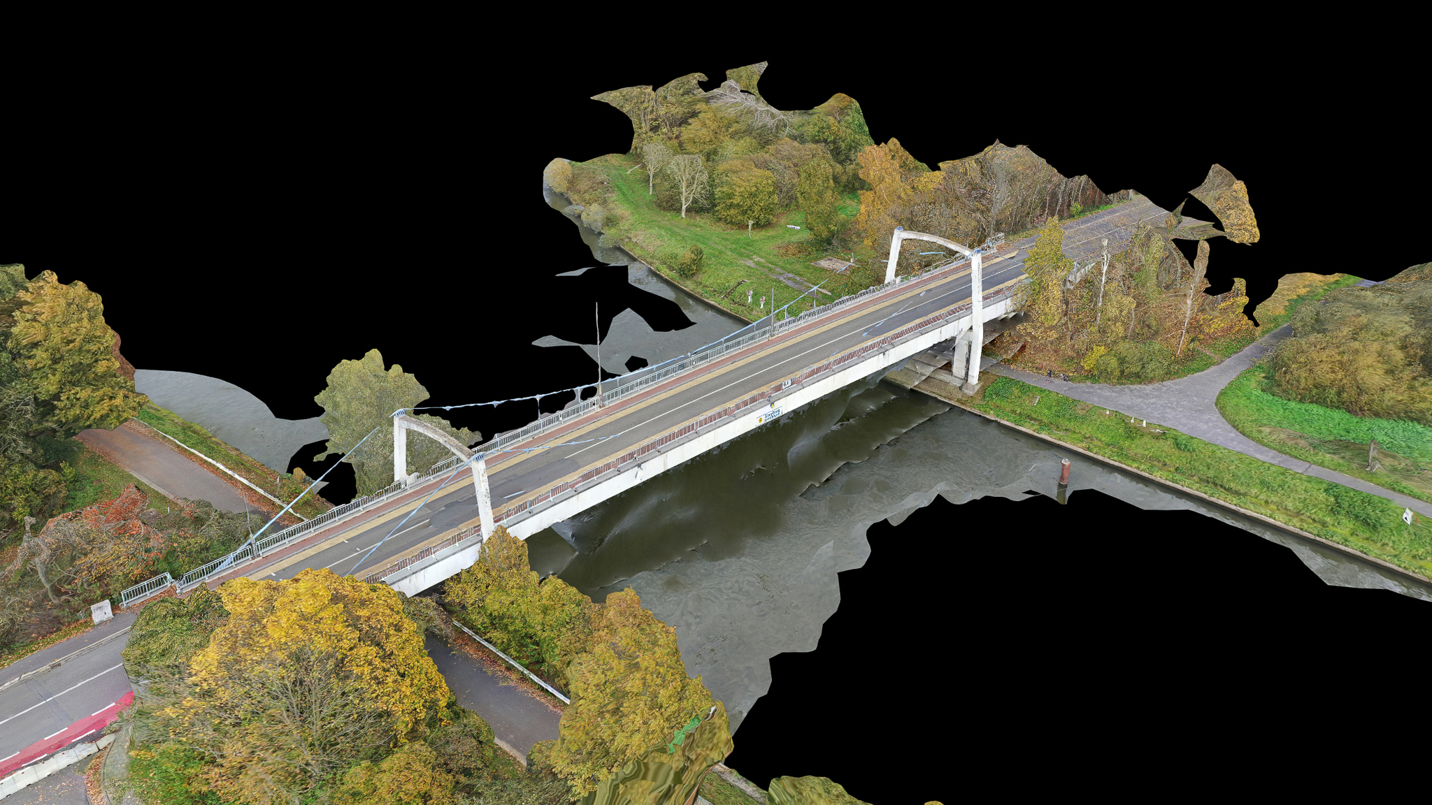
– Inspecting a bridge
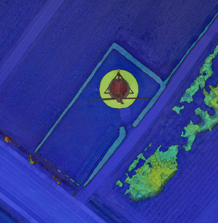
– Altitude map on a windmill
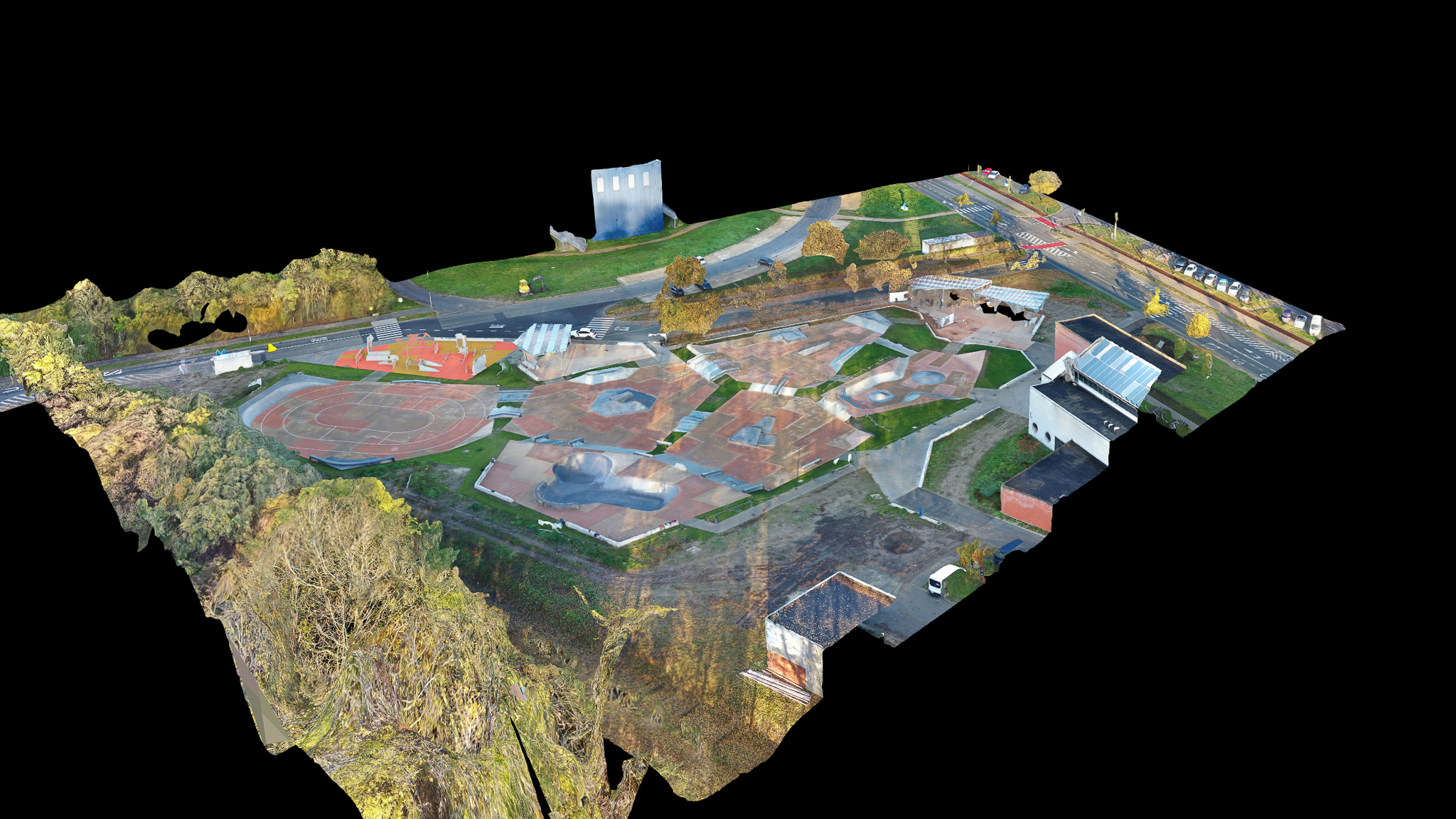
– The biggest skatepark in Belgium in 3D