The Oodnadatta Track, one of the epic outback tracks every 4×4 driver wants to drive (or at least, when you are an Australian or if you are in Australia). And we drove it in 2013.
The track itself starts in Marree, but to get there we drove from Hawker (check post about Flinders Ranges) via Leigh Creek along some interesting sights. Leigh Creek developed in the middle of  nothing, and we decided to do some sightseeing. It is very awkward to see a city with a park and trees in the outback … The mining business is still booming all over Australia. The road follows the railway, which is a history in its own. In 1878 the ‘Great Northern Railway’, or the ‘Afghan Express’ or the ‘Old Ghan’ as it was later called, opened in Port Augusta. It connected the people living remotely in the outback to the civilized world. In different phases stations opened as far as to Alice Springs. On the 31st of December 1980 the last train from Marree to Oodnadatta departed. Now tourists can discover the remains of the railway via the Old Ghan Railway Heritage Trail. At the other side of the highway however, a new railway emerged that is still in use today. We hoped to see the longest coal train on Earth when we stopped at Copley, but at the pub/hotel we got to know the train was out of service for some time due to repairs. Not surprising when you know the train only rides very early in the morning and very late in the evening because of the heat during the day … which we didn’t know J Beyond the next stop, Lyndhurst – nothing more than a fuel station annex roadhouse – the gravel road started. And immediately after Lyndhurst we made a small detour to the Ochre Cliffs.
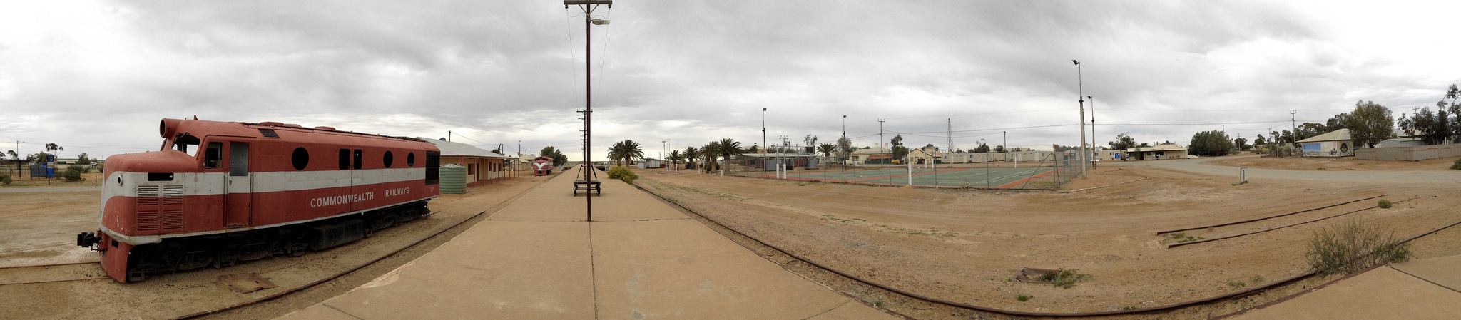
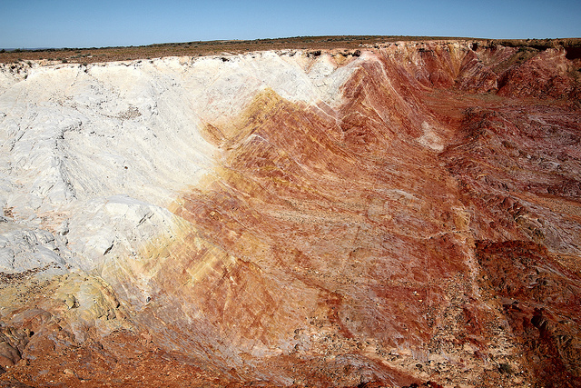 The views were spectacular! As far as you can see, there are cliffs, chasms and canyons. All dug out by the Aboriginal people to excavate the ochre for trade, to use as a body paint during ceremonies, as ornament on tools, as medicine, as paint or applied on bodies during the burial process. The colours are as amazing as the views. Further up north, we were curious to see the Farina ruins. This place once was a Ghan railway station, the ‘gangers’ used to live here (people responsible for the safe movement of trains over their section of the railway) and it served as an agricultural service centre. People believed they could grow grain in this harsh landscape … Farina means flower and if you are lucky enough you’ll pass at the right time when volunteers are actually baking bread! Those volunteers help to preserve the ruins (link artikel). It is hard to imagine people lived here when walking around this small town. 50 km up north we put up our camp for the night, at Marree. In the early days of the Ghan, Marree was the end station of the railway, until it was opened up to William Creek and Oodnadatta. It remained an important railway station for the pastoralists, like Sidney Kidman. Kidman’s cattle empire covered about 340,000 square kilometres at the time he died. The cattle was driven all the way to Marree to be put on the train to Port Augusta. Today the old trains are standing proud at the train station, which still looks maintained (the station, not the trains, those are very rusty …). Walking around this town is a bit like going back in time …
At Marree both the Birdsville Track and the Oodnadatta Track start (or end). We started the Oodnadatta Track under a cloudy sky, and soon stopped at Mutonia Sculpture Park (on the road book signed as Plane Henge, the most famous installation we presume). You cannot miss this open air exhibition of strange art works, made out of waste. The artist comes back every year to create a new piece. Soon after this odd stop, we started seeing Lake Eyre, the biggest salt lake of Australia (and the biggest internally draining catchment of the world). The part you see from the road, Lake Eyre South, is just a small piece of the lake, but even this looks enormous! Wonder how it looks like from the sky, but we didn’t flew over it (travel budget 😉 ). The lake fills up every now and then, when there are floods in Queensland. Sometimes you see railway bridges, or you drive in a creek. Again very hard to imagine, but these are rivers running from the lake … And there is more water. The many springs along the road, like Coward Springs we visited, are the result of the Great Artesian Basin squeezing to the surface. If there isn’t a spring, you are likely to see a mound spring, a mound formed by the mineralised material coming to the surface with the water. It is one of the world’s largest underground water reservoirs. The Oodnadatta Track lies on the western edge of 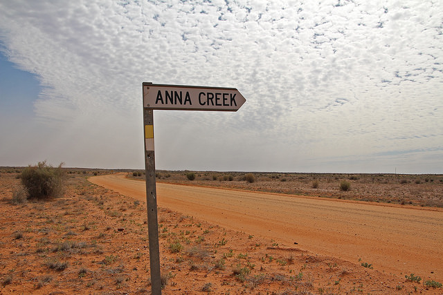 the Great Artesian Basin. As said before, we stopped at Coward Springs. In 1887 an artesian bore was sunk at the spring, in preparation of the coming railway. This wasn’t a great success, and a few years later an artificial wetland was all what’s left from the boring. However, it remained a Ghan stop, with a pub and a pool. The hotel doesn’t exist anymore, but the pool is still there!
From Cowards Springs, the sky started clearing, but with the clear sky a gusty wind came. It was so bad it forced us to drive from William Creek (where we were supposed to sleep and then drive further on to Oodnadatta and Marla) to Coober Pedy along the William Creek Road. Camping with a tent on the roof is adventurous … So, we didn’t drive the complete Oodnadatta Track, and it remains on our list to complete. But we did pass Anna Creek Station, a working cattle station the size of Belgium … with only 12 inhabitants (in comparison: we live with 11 million people on the same surface). And we saw a dingo, at a safe distance from us J
For those thinking there is nothing to do or see in the outback … think again! You can read more about Coober Pedy in a next blogpost.
See the full album on ![]()